The rich and famous can be found on our newsfeeds, fueling their obsession with space missions. But here's the plot twist: as they look upwards beyond the skies, there's another unexplored frontier miles below.
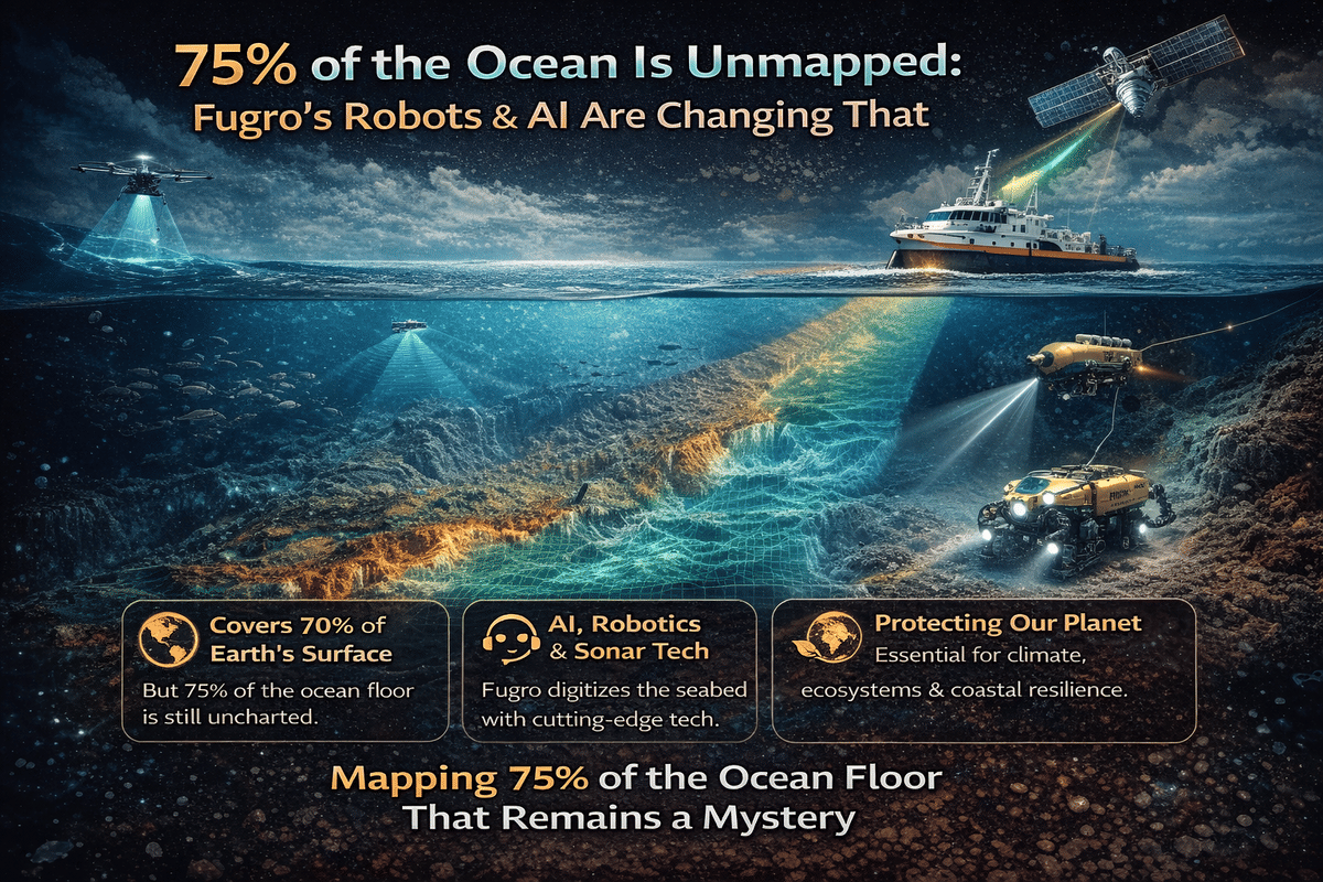
Despite covering 70% of Earth's surface, only 25% of the ocean floor has been mapped, as the majority of our planet, where we all reside, remains a complete mystery. That staggering knowledge gap is what Fugro, a company quietly transforming offshore surveying, is setting out to change.
Mike Liddell, Program Director Future Workforce at Fugro, takes me on a voyage to the bottom of the sea as we discuss the technology exposing the secrets hiding on the ocean floor.
Key Takeaways
70% of the Earth's surface is covered by water. But only a quarter of it has been mapped.
Fugro is digitizing the seabed using AI, sonar, robotics, and remote operations.
The ocean is Earth's primary life support system, storing more carbon and producing more oxygen than any other ecosystem on the planet.
Surveying in Fog While on a Roller Coaster
Describing the marine environment isn't easy. But Liddell offered a wild comparison of what their work involves. He said:
"It's a bit like surveying above the water line in heavy fog, where you can hardly see your hand at the end of your arm, while on a roller coaster."
The physics of light and radio waves breaks down quickly under pressure and depth. So Fugro relies on sonar systems, sensors, and subsea drones when close to the seabed.
When thousands of meters beneath the surface, this tech enables teams to collect data on everything from seabed composition and geological risk to flora and fauna thriving in total darkness.
But the captured information will play a critical role in the safe installation and maintenance of offshore infrastructure, including wind farms.
"These offshore wind farms often cover vast areas and are bigger than major cities," explained Liddell. "They involve multiple vessels, and hundreds of people, spread over months or even years."
Fugro is mapping and monitoring some of the most complex seabed environments on Earth. And while the scale is already immense, the demand is only growing. Electrification, energy independence, and net zero targets have created enormous pressure to deliver faster and smarter.
"We're focused on automation in those workflows, how we can drive greater efficiency," said Liddell. "Even small improvements often have pretty significant benefits."
Unlock the power of precision with SeisWind® 3D! Dive deep into the world of offshore wind projects with @fugro cutting-edge technology. Access ultra ultra high-resolution seismic data and precise mapping for informed decision-making.
— Wevolver (@WevolverApp) December 21, 2023
Video source: @fugro #tech #innovation pic.twitter.com/WsffzRQgMg
The Depths Below Are Busy Places
The seabed may appear vast and empty. But once you go beneath the surface, you'll find cables, pipelines, wind turbine foundations, and subsea infrastructure that support everything from global internet traffic to energy supply.
Each of these assets needs regular inspection. They need to be protected from shifting geology, collisions, and even human interference. That's another reason why remote sensing and real-time data matter so much.
Liddell explained:
"We're inspecting infrastructure. We're ensuring there's no damage to pipelines. We're ensuring there haven't been any hostile actors damaging infrastructure or any collisions."
This level of monitoring wasn't possible just a few years ago. Now, it has become a standard procedure.
Satellite Connectivity That Doesn't Feel Like Dial-Up
Until recently, offshore connectivity was, at best, clunky. "Two or three years ago, the bandwidth we had on vessels was probably more akin to the dial-up modem that we had in our houses 20-odd years ago," Liddell recalled.
That limitation forced crews to work in isolation. All data processing, decision-making, and coordination had to occur on the vessel, as there was no reliable connection to land.
But now? "High-bandwidth internet connections of a similar speed to what we have in our homes now are available, largely anywhere in the oceans," Liddell confirmed.
Fugro is now integrating geostationary satellites and low-Earth-orbit (LEO) constellations, such as Starlink, into its operations.
"We're focused on how we can best leverage multi-constellation solutions… to ensure that we have very high reliability of connection to the vessel," he said. That shift doesn't just make communication easier. It opens the door to full-scale remote operations.
When Surveyors Don't Want to Leave the Shore
It's no secret that offshore work is demanding. "Some of our staff spend maybe six or eight months of the year offshore," said Liddell. "That type of work-life balance is not attractive to a younger generation."
Add in survival training, rigorous medicals, and the physically isolating nature of the job, and you start to see why recruitment is a challenge. Fugro's answer? Remote Operation Centers, or ROCs.
Liddell explained:
"We're focused on building an onshore environment where we can deliver a lot of those same services. It provides an onshore career path for people who have gained valuable experience offshore."
These centers aren't just about convenience. They widen the talent pool, support career longevity, and enable better gender diversity. And while offshore roles still exist, particularly for complex missions, automation is steadily changing the equation.
The Uncrewed Vessels Running the Show
Liddell told me:
"For thousands of years, humans have navigated the seas with people on board vessels; now, vessels are robots."
Fugro's uncrewed surface vessels (USVs) are no longer prototypes of the future. They're active, intelligent, and operate remotely from ROCs. These robotic ships can deploy subsea drones known as ROVs, each with onboard decision-making capabilities, to inspect deep-sea infrastructure, scan for damage, or monitor for tampering.
"From that robot ship, we're deploying another subsea robot that dives down to the seabed," he said. "And that's really pretty cool." And it's not just cool. It's more efficient, more scalable, and substantially better for the planet.
Most artificial intelligence (AI) in the marine sector has been deployed after the data is collected. That's changing.
Liddell explained:
"We're already seeing AI tools involved in our workflows… but the next big step is integrating these AI tools with edge processing capabilities."
This allows decisions to be made on the fly. Should the vessel slow down? Does a section of the pipeline need a second look? Does the sensor need to capture more data at a different angle?
"That autonomy will become more and more capable within our marine robots," he added. "AI starts to play an important role there."
Mapping Mountains That No One Has Ever Seen
All of this culminates in one unforgettable moment from Liddell's career. He told Techopedia:
"It was the late 90s, doing a cable route survey offshore Brazil… the seabed had been very flat for hours," he recalled. Suddenly, his sonar station lit up. I saw this underwater mountain starting to appear… this seamount, thousands of meters high, sticking out of the seabed, emerged. And we mapped it at a resolution that had really never been mapped before."
That was the day he felt like an explorer. Not on Mars. Not on the Moon. But thousands of meters beneath the waves.
The Bottom Line
Although we are told that the rainforests are the lungs of our planet, Liddell believes it's the oceans, and he has the stats to back up his claims.
"The oceans store 60 times more carbon than the atmosphere and provide 80 percent of the oxygen that we breathe," he said.
Despite its importance, nearly three-quarters of the ocean floor remains unmapped. There is an increasing importance to have a much better understanding of the composition of our oceans and the characteristics of the seafloor.
If we want to protect life, energy, and the climate, maybe we should stop looking to the stars for answers. After all, some of the biggest questions are waiting for us on the seabed.
FAQs
Why is mapping the ocean floor important?
Mapping the ocean floor helps us understand Earth's ecosystems, support offshore infrastructure like wind farms and cables, and monitor environmental and climate changes.
How is Fugro using technology to map the seabed?
Fugro uses AI, sonar, robotics, and uncrewed vessels to collect real-time data, enabling faster, safer, and more efficient ocean exploration.
How much of the ocean floor has been mapped so far?
Only about 25% of the ocean floor has been mapped, leaving 75% unexplored and full of undiscovered features and ecosystems.